Portfolio
A selection of interactive data studies, photography, and projects at the intersection of urban planning, geospatial analysis, and visual communication.
NestScore
A rental-finder I built that scores listings 0–100 on the things that actually shape daily life—transit, groceries, parks, and commute—so renters can compare apartments on more than just price.
Visit nestscore.ca →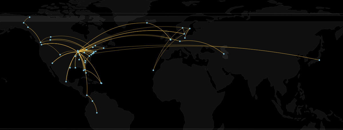 Interactive
 Data Visualization
Flying: 124 Flights, Visualized
A personal data study of every flight I’ve logged since 2011—an animated route map, cumulative distance, on-time performance, and the planes I’ve flown.
View study →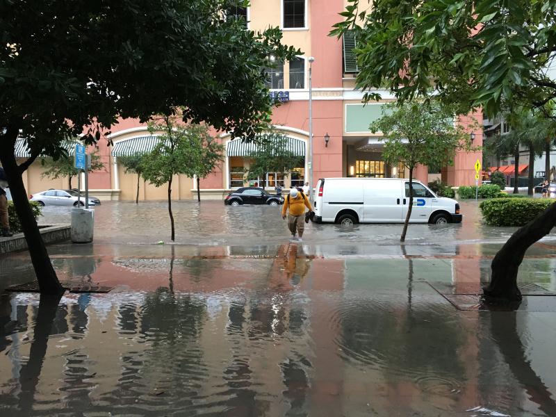 StoryMap
 Data Visualization
Sea-Level Rise Susceptibility: Miami
A StoryMap I authored on navigating rising waters in a rapidly developing downtown—mapping flood exposure against Miami’s booming tall-building pipeline.
View study →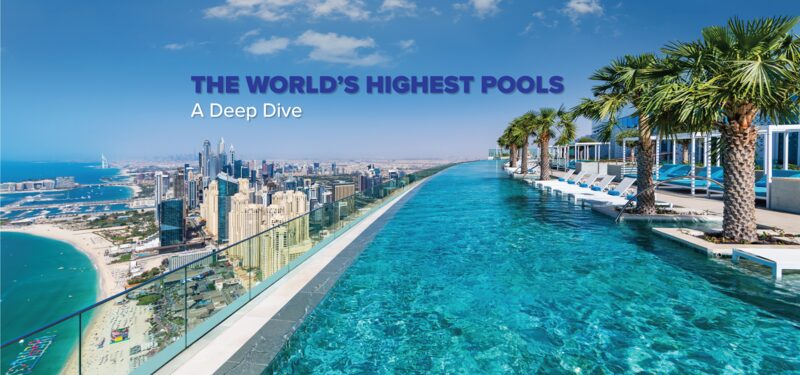 Interactive Study
 Data Visualization
The World’s Highest Pools
A global audit I co-authored of pools in the world’s 200 supertall buildings—108 of which have one—and the research behind the CTBUH’s formal definition of an “infinity pool.”
View study →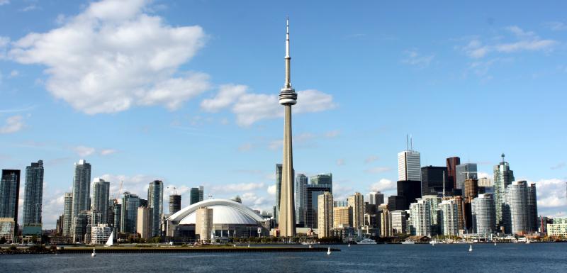 StoryMap
 Data Visualization
Vertical Urbanism Index: Toronto
A case study applying the Vertical Urbanism Index to Toronto—scoring how well the city balances density, design, and liveability as it grows upward.
View study →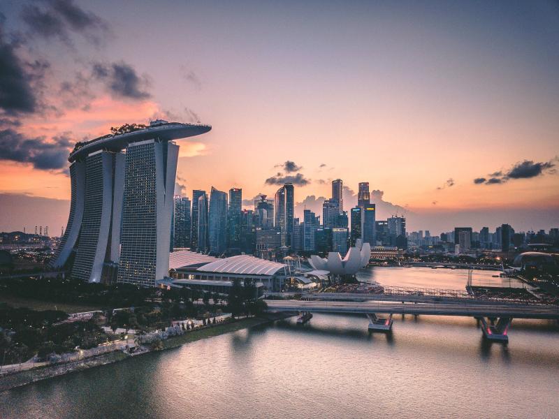 StoryMap
 Data Visualization
Green Growth: Singapore From Above
A visual study of how Singapore turned land and resource constraints into a model for biophilic, high-density living that reshaped its skyline.
View study → Interactive Study
 Data Visualization
The World’s 100 Tallest Cities (2025)
The 2025 edition of the CTBUH Data Handbook, ranking the world’s 100 tallest cities and tracking how global tall-building activity is shifting.
View study → StoryMap
 Data Visualization
New or Renew: Europe’s Tallest Cities
An interactive look at how Europe’s major cities weigh building new towers against renewing existing ones to grow their skylines responsibly.
View study →Projects
NestScore
A rental-finder I built that scores Toronto listings 0–100 on what actually shapes daily life—transit, groceries, parks, and commute.
Open →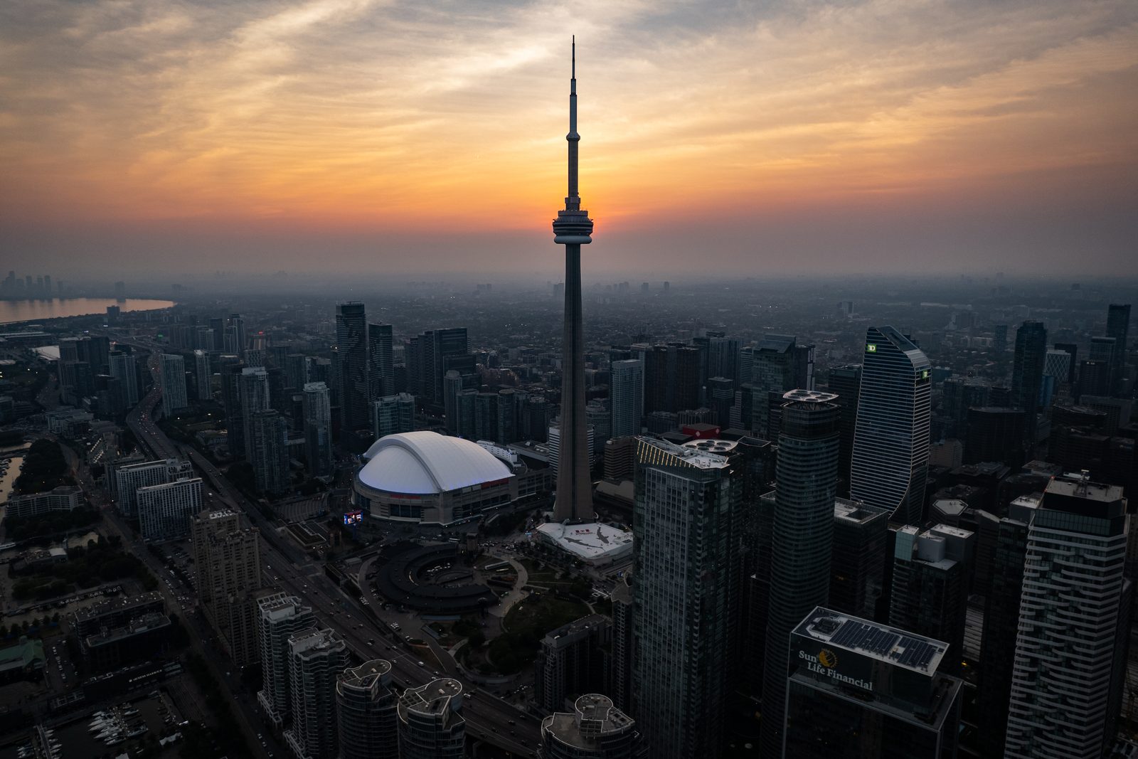 Drone
Drone Photography
Toronto at Golden Hour
The downtown core and CN Tower silhouetted against a hazy summer sunset, looking west over the waterfront.
View study →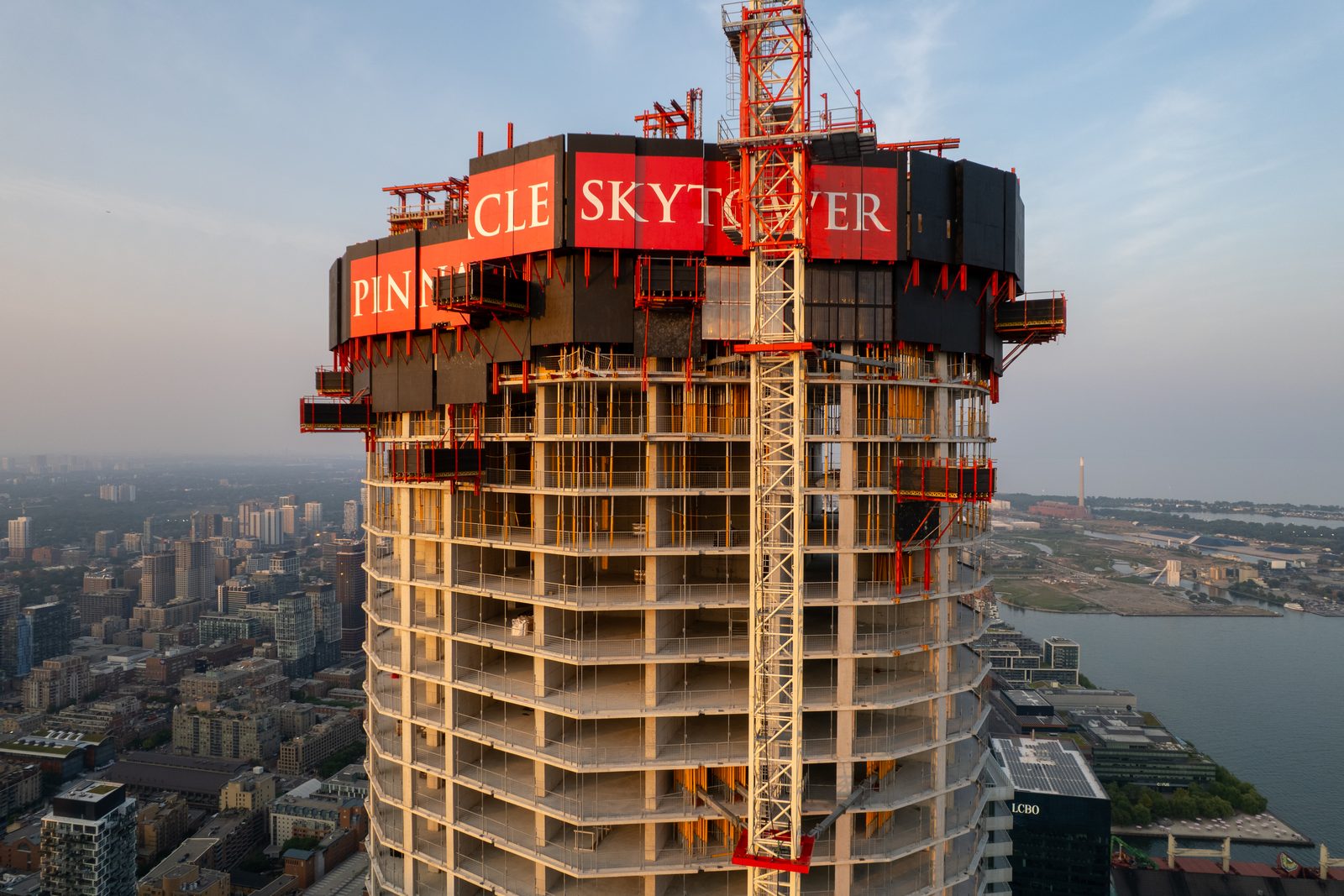 Drone
Drone Photography
SkyTower Rising
Pinnacle One Yonge’s SkyTower under construction on Toronto’s waterfront, caught in early-morning light.
View study →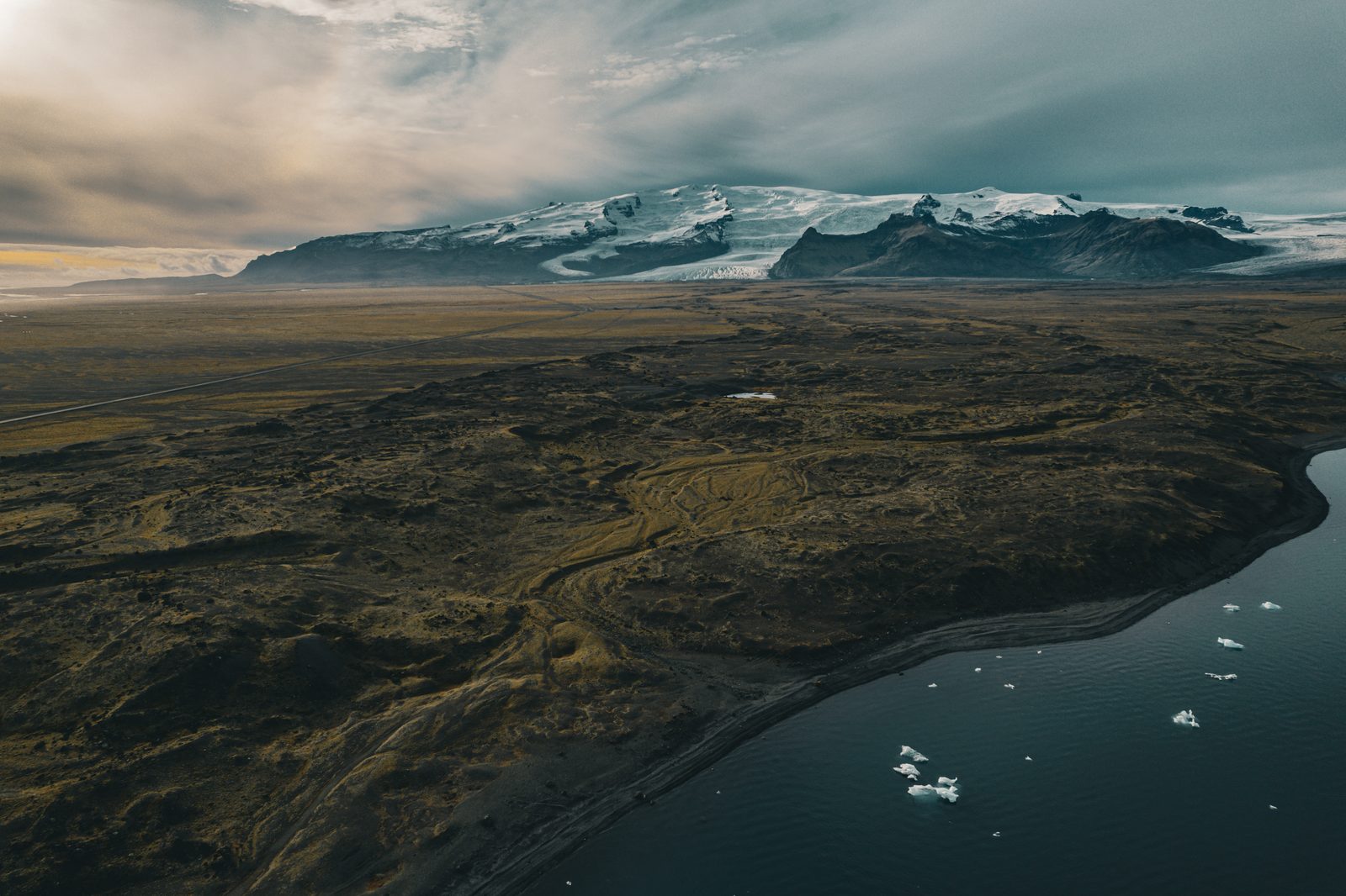 Drone
Drone Photography
Glacier Coast, Iceland
A snow-capped glacier meeting Iceland’s black-sand shore, with icebergs drifting in the water below.
View study → Ground
 Photography
CN Tower, From Below
Looking straight up at the CN Tower’s main pod and SkyPod against a moody, sunset-streaked sky.
View study → Ground
 Photography
TD in the Clouds
The sweeping glass curve of a downtown Toronto tower, its TD sign glowing under an overcast sky.
View study →More work in this category is coming soon.